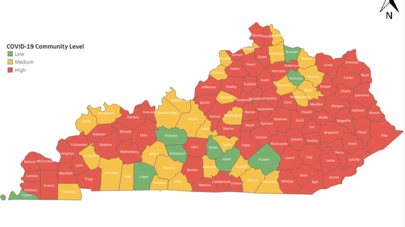
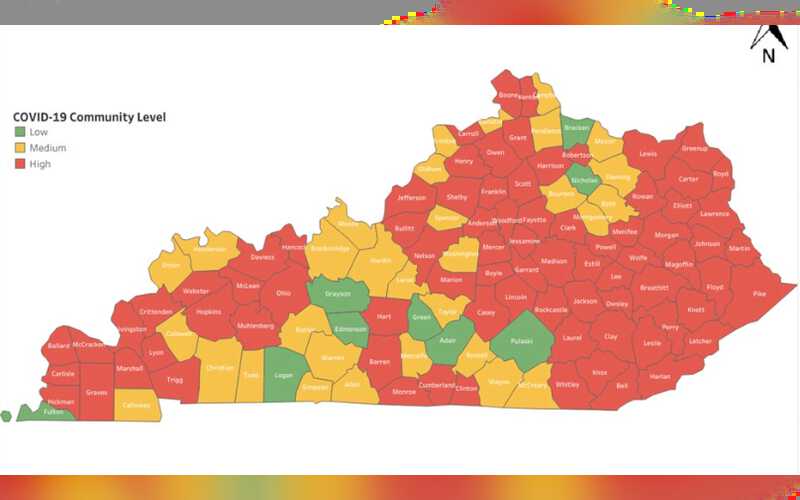
Russell County remains yellow on the latest COVID spread map released by the Kentucky Department for Public Health.
Meanwhile, neighboring Adair and Pulaski County have moved to green, indicating a low level of community spread of the virus.
Yellow indicates a medium spread, while red indicates a high spread.
Neighboring Wayne County is also yellow, while Casey, Clinton, and Cumberland counties are in the red.